Tropical Cyclones
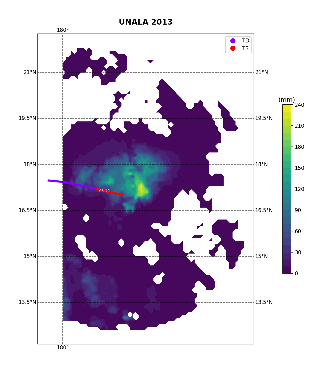
Tropical Cyclone Accumulated Precipitation from NASA GPM-IMERG satellite information:
Best track information for UNALA
| SID |
SEASON |
BASIN |
SUBBASIN |
NAME |
JULIAN DATE |
DATE |
WIND SPEED |
PRESSURE |
CLASSIFICATION |
RADIUS MAX. WIND |
STORM SPEED |
STORM DIRECTION |
LATITUDE |
LONGITUDE |
| CP022013 |
2013 |
EP |
Central Pacific |
UNALA |
2456523.500 |
2013081900 |
35 |
1005.0 |
TS |
30 |
18 |
282 |
17.0000 |
-177.900 |
| CP022013 |
2013 |
EP |
Central Pacific |
UNALA |
2456523.625 |
2013081903 |
32 |
1006.0 |
TD |
30 |
19 |
283 |
17.1677 |
-178.682 |
| CP022013 |
2013 |
EP |
Central Pacific |
UNALA |
2456523.750 |
2013081906 |
30 |
1007.0 |
TD |
30 |
16 |
280 |
17.3000 |
-179.400 |


 Contact Us
 | ©2012 Department of Earth & Environment, Florida International University
This TC IMERG website is created by Luis Hernadez (undergrad), Jeremy Rodriquez (undergrad), Dr. Oscar Guzman (Postdoc Researcher), and Dr. Haiyan Jiang.
The work is supported by the NSF Scholarships for a Future Generation of Geoscience Professionals Grant #1834066, NSF Grant #1947304, and NASA WAAD grant #NNX17AH72G

